16 in stock
€14.95
16 in stock
![Mount Rogers High Country Map [Grayson Highlands State Park] (National Geographic Trails Illustrated Map, 318)](https://bryceexplorer.com/wp-content/uploads/2025/10/mount-rogers-hi_0.jpg)
![Mount Rogers High Country Map [Grayson Highlands State Park] (National Geographic Trails Illustrated Map, 318) - Image 2](https://bryceexplorer.com/wp-content/uploads/2025/10/mount-rogers-hi_1.jpg)
![Mount Rogers High Country Map [Grayson Highlands State Park] (National Geographic Trails Illustrated Map, 318) - Image 3](https://bryceexplorer.com/wp-content/uploads/2025/10/mount-rogers-hi_2.jpg)
![Mount Rogers High Country Map [Grayson Highlands State Park] (National Geographic Trails Illustrated Map, 318) - Image 4](https://bryceexplorer.com/wp-content/uploads/2025/10/mount-rogers-hi_3.jpg)
![Mount Rogers High Country Map [Grayson Highlands State Park] (National Geographic Trails Illustrated Map, 318) - Image 5](https://bryceexplorer.com/wp-content/uploads/2025/10/mount-rogers-hi_4.jpg)
![Mount Rogers High Country Map [Grayson Highlands State Park] (National Geographic Trails Illustrated Map, 318) - Image 6](https://bryceexplorer.com/wp-content/uploads/2025/10/mount-rogers-hi_5.jpg)
![Mount Rogers High Country Map [Grayson Highlands State Park] (National Geographic Trails Illustrated Map, 318) - Image 7](https://bryceexplorer.com/wp-content/uploads/2025/10/mount-rogers-hi_6.jpg)
![Mount Rogers High Country Map [Grayson Highlands State Park] (National Geographic Trails Illustrated Map, 318) - Image 8](https://bryceexplorer.com/wp-content/uploads/2025/10/mount-rogers-hi_7.jpg)
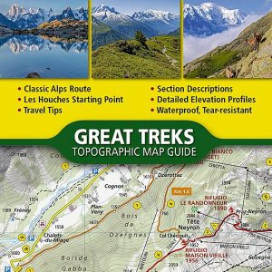
**Mount Rogers High Country Map [Grayson Highlands State Park] (National Geographic Trails Illustrated Map, 318)**
Explore the breathtaking landscapes of Grayson Highlands State Park with the Mount Rogers High Country Map, a detailed and user-friendly guide produced by National Geographic. This meticulously crafted map (No. 318) is an essential companion for outdoor enthusiasts, hikers, and nature lovers looking to navigate the stunning trails and diverse terrain of Virginia’s majestic high country.
**Key Features:**
– **Detailed Topography:** The map offers comprehensive topographic information, including elevation contours and relief shading, providing an accurate depiction of the rugged terrain and natural features of the area.
– **Trails & Landmarks:** Navigate over 100 miles of well-marked hiking trails, including the famous Appalachian Trail, with clear trailheads and points of interest. Discover scenic overlooks, waterfalls, and unique geological formations along your journey.
– **Water Sources & Campsites:** Easily locate streams, rivers, and designated campsites, ensuring you stay hydrated and find the perfect spot to pitch your tent under the stars.
– **Wildlife & Flora:** The Grayson Highlands are renowned for their diverse wildlife and plant species. This map highlights key areas for birdwatching and spotting the park’s iconic wild ponies.
– **Durable & Weather-Resistant:** Printed on high-quality, tear-resistant material, this map is designed to withstand the rigors of outdoor use. Its waterproof features make it ideal for any weather conditions, ensuring it remains intact and legible throughout your adventures.
– **Easy-to-Read Design:** With a clear and vibrant layout, you’ll easily find your way around the park. The map includes a detailed legend and scale, making navigation straightforward and intuitive.
Whether you’re planning a day hike or an extended backcountry trip, the Mount Rogers High Country Map is your go-to resource for exploring Grayson Highlands State Park. Elevate your outdoor experience with this essential tool that combines accuracy, durability, and convenience.
**Get ready to embark on your adventure and discover the natural beauty of Virginia’s high country with the Mount Rogers High Country Map!**